June 12, 2024
Links
Red River Basin Links
There are many agencies/organizations and corresponding websites that are dedicated to natural resource management in the Red River basin. One of the most comprehensive assortments of links to these various entities is available through the international Red River Basin Commission's website.
Red River Basin Commission
Red River Basin Natural Resources Framework Plan
The complex nature of the Red River Basin has resulted in challenges to effective, integrated land and water management. As such, the Red River Basin Commission has developed the “Natural Resources Framework Plan” - a framework plan will aid in achieving a basin-wide approach to integrated natural resource management, and provide a framework for overcoming political barriers.
Also available are the NRFP Executive Summary and NRFP Action Agenda.
Long Term Flood Solutions
The 2009 Minnesota and North Dakota state legislatures each appropriated $500,000 for the Red River Basin Commission to develop a comprehensive strategy to address flood solutions in the Red River basin. That effort is now referred to as the Long Term Flood Solutions Project.
The overall purpose of this effort is to develop flood damage reduction strategies, and long term flood solutions in the Red River basin.
International Water Institute
Red River Basin Mapping Initiative
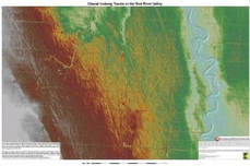
The International Water Institute has been managing this mapping initiative "to develop and publicly deliver a seamless and highly accurate digital elevation map of the entire Red River Basin." The tool used in this process is called Light Detection and Ranging, or LIDAR, which involves an integration of airborne laser and GPS technology. LIDAR measurements allow precise calculation of land surface elevation, within a few inches.
Red River Joint Water Resource District
1201 Main Ave W
West Fargo, ND 58078
1201 Main Ave W
West Fargo, ND 58078
